
File:Carlton 1956 2048px.jpg
Jump to navigation
Jump to search
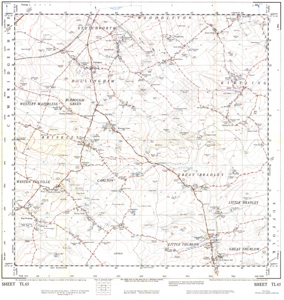

Size of this preview: 568 × 600 pixels. Other resolutions: 227 × 240 pixels | 2,048 × 2,163 pixels.
Original file (2,048 × 2,163 pixels, file size: 1.74 MB, MIME type: image/jpeg)
1956 Ordnance Survey Map of scale 1:25,000, sheet TL65.
File history
Click on a date/time to view the file as it appeared at that time.
| Date/Time | Thumbnail | Dimensions | User | Comment | |
|---|---|---|---|---|---|
| current | 16:50, 11 May 2015 | | 2,048 × 2,163 (1.74 MB) | Hfrancis (talk | contribs) | 1956 Ordnance Survey Map of scale 1:25,000, sheet TL65. |
You cannot overwrite this file.
File usage
The following page uses this file: