
Difference between revisions of "1949 Aerial Photographs"
Jump to navigation
Jump to search
| Line 9: | Line 9: | ||
Carlton All 2048.JPG|Carlton Hill | Carlton All 2048.JPG|Carlton Hill | ||
1949 CarltonGreen.JPG|Carlton Green | 1949 CarltonGreen.JPG|Carlton Green | ||
| − | 1949 | + | 1949 Burrough Green 201799 2048px.JPG|Burrough Green |
1949 Six Mile Bottom 200951 2048px.jpg|Six Mile Bottom (i) | 1949 Six Mile Bottom 200951 2048px.jpg|Six Mile Bottom (i) | ||
1949 Six Mile Bottom 200960 2048px.jpg|Six Mile Bottom (ii) | 1949 Six Mile Bottom 200960 2048px.jpg|Six Mile Bottom (ii) | ||
Revision as of 17:29, 24 May 2015
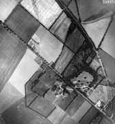
I have a selection of original photographic prints of aerial pictures of Carlton and some of the surrounding villages.
These were too big (53cm x 48cm) to scan with an A4 or A3 scanner, so they had to be professionally scanned by a company who has a bigger scanner than I do!
Villages
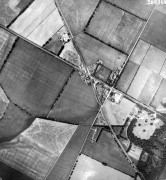
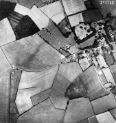
Carlton Hill
Carlton Green
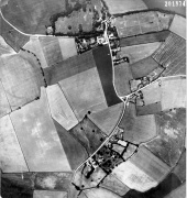
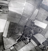
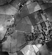
Burrough Green
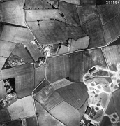
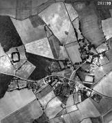
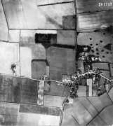
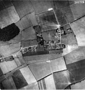
Six Mile Bottom (i)
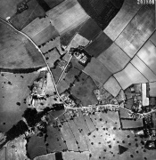
Six Mile Bottom (ii)
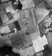
Streetly End
- 1949 WestonGreen 2048.JPG
Weston Green (Weston Colville)
- 1949 WestonGreenSouth 2048.JPG
Weston Green and West Wratting Common Road
West Watting (West)
West Wratting (East)
Brinkley (West)
Brinkley (East)
Westley Waterless (West)
Westley Waterless (East) and Burrough End


Villages I have photographs for are:
- Carlton
- Carlton Green
- Brinkley
- Weston Colville
- West Wratting
- Streetly End
- Burrough Green
- Six Mile Bottom